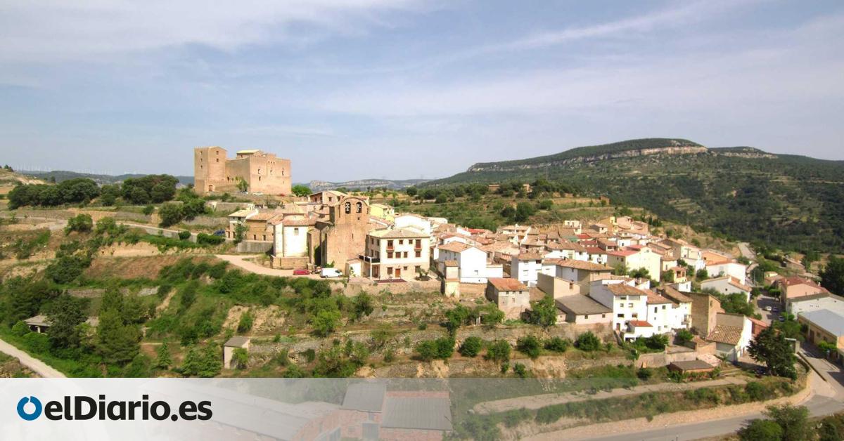
Todorera is a small municipality in the Els Ports region, in the northern province of Castellón, Valencia. The city center is spread out on the mountain slope, thanks to which streets, squares and historical buildings are arranged. The sparsely populated town has preserved the typical structure of a mountain village, and its spatial organization reflects centuries of adaptation to the relief and natural environment.
Todorera’s history can be seen in its buildings and its relationship to the Cantavieja River, which flows through the town. Over the centuries, it developed with a combination of defensive, economic and religious functions, resulting in a complex heritage site that included fortifications, bridges, hermitages and parish churches. The arrangement of these buildings allows you to explore the municipality according to the arrangement of its streets and squares, offering a first approach to the castles, bridges and religious monuments that make up its historical heritage.
Medieval and religious monuments of Todorera
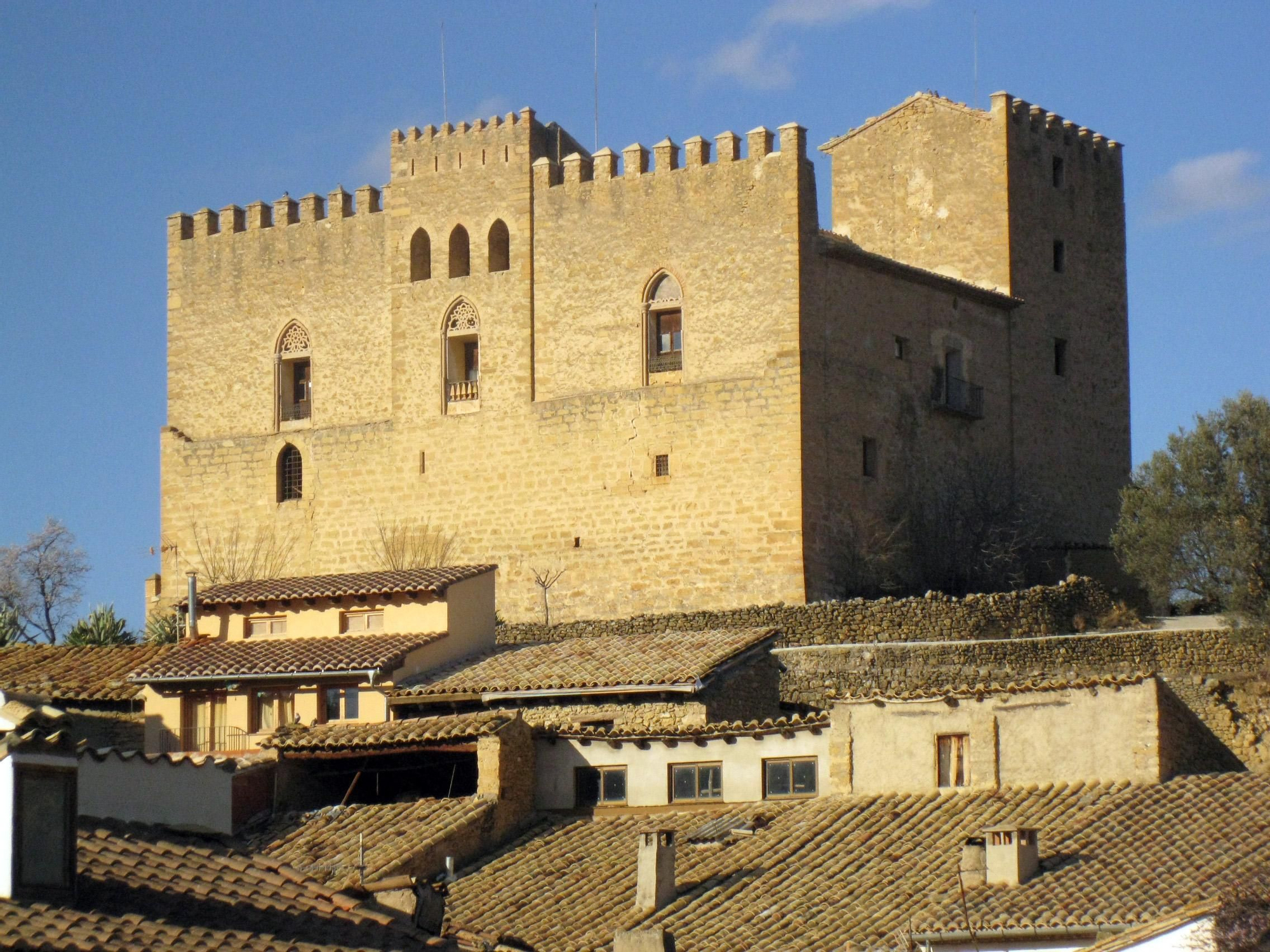
The center of Todorera is organized around a hillside, with Todorera Castle on the highest point overlooking the valley and town. The rectangular plan, connected by several bodies around a central patio, integrates towers and walls that recall the defensive functions it had for centuries. The interior rooms show the separation between noble and auxiliary areas and reflect the evolution of the building from its original construction to its subsequent renovation. From the fortress, you can see how the different elements of the municipality are represented in reliefs and around the Cantavieja River.
The Cantavieja River crosses Todorera, adjusting the layout of the bridge. The Gothic bridge, built in 1397, connects the city’s lowlands and highlands and allows you to visualize the town’s plan along the riverbank. Its wide central eye and second smaller eye show how its structure adapted to the circulation of people and vehicles. A few meters away was the first mill bridge to cross the river, bringing residents closer to mills, an important element of water mill management and daily life. Cross these bridges and follow the roads that have connected the towns for centuries.
Worship spaces are integrated into this urban and natural route. The Hermitage Museum in San Onofre, near Puente del Molino, shows how religion accompanies everyday activities, linking places of prayer with spaces of movement and work. From the top of the hillside, San Cristobal’s Hermitage offers wide views of the municipality and valley. I recall that religious buildings were strategically placed so that they could be seen from various points.
The Parish Church of San Bartolomé, located in the central square, is an expression of the social and spiritual life of the town. Its Greek cross plan and altarpiece are integrated into routes connecting streets, squares and defensive buildings, allowing us to understand how Todorela was organized over time.
The complex of castles, bridges, hermitages, and churches shows the interplay of defense, transportation, economy, and religious life. Each element has preserved its historical function and is recognized as part of a route through which the history of the city can be traced in the everyday experience of traveling through space and the city. The layout of the buildings reflects how Todorera adapted to its topography and riverbed, maintaining a historical continuity that can still be seen as you walk through its streets and squares.