
Aragon’s Pyrenees has several lakes formed by glaciers that shape the mountain landscape. Among them is Lake Escalar, located in the department of Huesca, in the city of Jaca, near the Astún ski resort. Due to its high altitude, it is a common destination for those who want to take a walk in the mountains without having to travel too strenuous a route.
The lake’s surrounding environment is a combination of valleys, slopes, small gorges and streams that flow into the Aragon River. Weather can change rapidly due to the height of the lake, so we recommend planning your trip and wearing appropriate clothing and footwear. Despite this, the route is easily accessible and well signposted, allowing walkers of varying experience to approach the lake safely.
Moreover, from Lake Escalar, you can connect to other points nearby, such as Lake Torchas or Monges Hill, allowing you to extend your tour if you wish. This makes the region a good starting point for exploring the Aragon Mountains, offering varied landscapes and well-marked routes without having to venture through complex terrain.
The area around Lake Escalal is part of a natural space managed by the Aragon State Government, where conservation of landscape and biodiversity is promoted. In this area, you can see alpine-adapted plants, as well as birds and small mammals that live in valleys and valleys. The presence of native flora and fauna means that your walk will not only touch on the landscape, but also on the ecological richness of the Pyrenees.
Route to Ybon de Escalar
The complete route from Astún to Ibom de Escalar and back is approximately 4.3 kilometers long and has a cumulative elevation gain of 360 meters, making it among the short and medium excursions in the region. Access to the lake begins at the end of the Astun Ski Resort facility and follows a gravel road that crosses under the Tulchas chairlift.
The road continues to curve, until at a certain point pedestrians can choose to continue along the main road or take a detour along a dirt road, resulting in a slightly shorter distance. Both routes meet at a small pond in the Escala Valley, marking the beginning of the final leg towards the lake.
From the pond, the route remains constant next to the valley, following the path that borders the left bank of the channel until it reaches the lake. In the first meters, the terrain is wide and has a gentle slope, making it easier to follow. The path gets a little steeper as you climb, and in spring there may be streams and wetlands, so waterproof footwear is recommended.
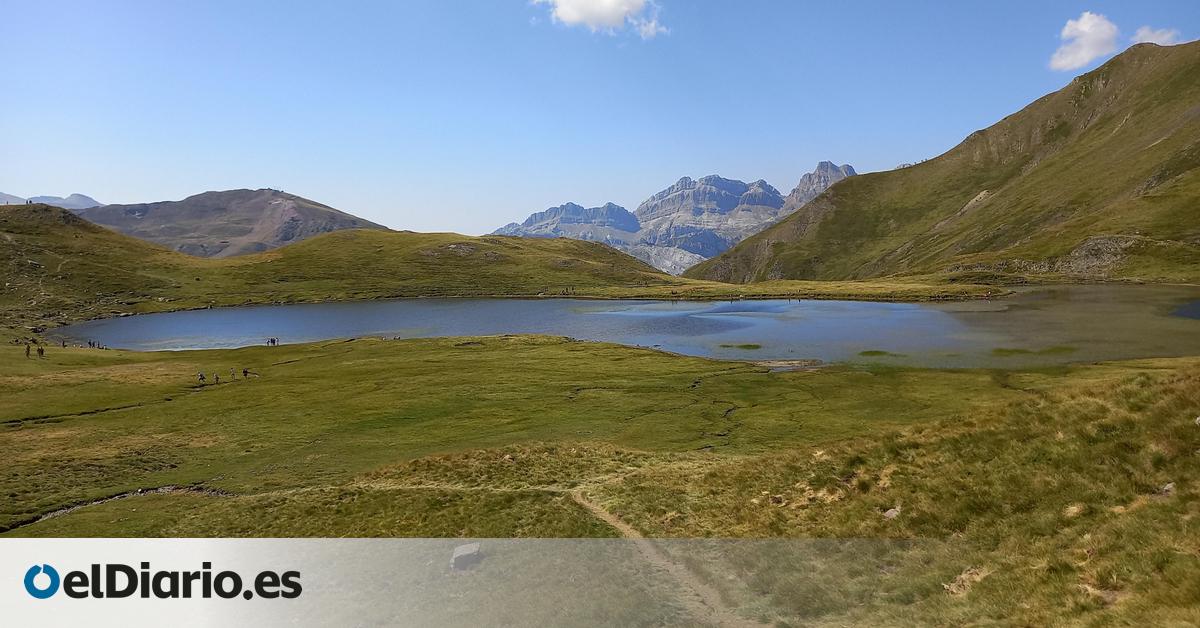
Further along, the surface becomes rocky, but milestones clearly mark the route to be followed. This section is non-technical and can be safely navigated to Lake Escala at 2,078 meters above sea level. Depending on the light, the color of the water changes from orange to a deeper blue, and from the shore you can see nearby mountains such as Candanchu.
There are several options for those wishing to continue the tour. You can either go around the lake or take the route to Lake Torchas, which is flat at an altitude of 2,144 meters, about 1.5 kilometers away, or go to Collado de los Monges, 600 meters away, on an 80 meter slope with views of the Ossau Valley. These alternatives allow you to extend your walk without deviating from the marked route or significantly increasing the difficulty of the main route.